


Forecast models show potential late week storm and snow in US East
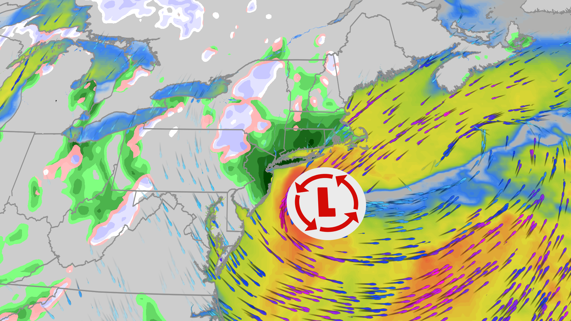
Weather forecasts indicate a developing storm system could strengthen into a nor'easter off the East Coast by late week. The system is expected to lower temperatures by around 20 degrees across eastern states and bring the first accumulating snow of the season to inland areas and higher elevations. Coastal regions and major cities are more likely to experience heavy rain and gusty winds.
What happened
- Wednesday
A low-pressure system moves across the Midwest into the Ohio Valley, spreading rain from Michigan south to Georgia [1].
- Thursday night
A secondary low forms off the East Coast, creating conditions for rain to transition into wet snow over parts of the interior Northeast [1].
- This weekend
Cold Canadian air pushes south across the eastern half of the country, dropping overnight low temperatures into the 30s as far south as Florida [1], [2].
What you need to know
Accumulating snow is expected mainly in higher elevations, including the Appalachians, upstate New York, and northern New England.
Major urban areas along the Interstate-95 corridor are forecast to receive rain instead of snow as temperatures remain above freezing.
Daytime high temperatures could drop by 20 degrees between Wednesday and Friday from Chicago down to Atlanta.
Coastal areas along the East Coast may experience high-tide coastal flooding, rain, and strong wind gusts.
The exact track and strength of the storm are not fully confirmed yet. Meteorologists are watching computer models to see how close to the coastline the low-pressure system will move.
Background
A nor'easter is defined as any low-pressure area off the East Coast that produces winds blowing in from the northeast. While they occur throughout the year and do not always produce snow, winter systems can generate heavy snowfall when cold air is present.
The upcoming weather pattern is driven by a strong southward dip in the polar jet stream along with high-pressure air over the western US. An early disturbance in the stratospheric polar vortex over the Arctic has also helped push cold Canadian air southward into the eastern United States.
Questions people ask
Will major East Coast cities see snow from this storm?
Major cities along the I-95 corridor are expected to get rain rather than snow because temperatures in those areas will likely stay above freezing.
Where is snowfall most likely to accumulate?
Accumulating snow is most probable in mountain regions and higher terrain across northern New England, upstate New York, and the Appalachians.
What makes a storm a nor'easter?
A storm is considered a nor'easter simply when a coastal low-pressure system brings winds out of the northeast, regardless of whether it drops snow.
Where this came from

Found through Google Trends and drafted with AI from at least two cited sources. Published automatically after passing our automated checks for sources, wording and safety. It may not have been reviewed by a person yet. Report a correction.