


Why is MetService trending in New Zealand?
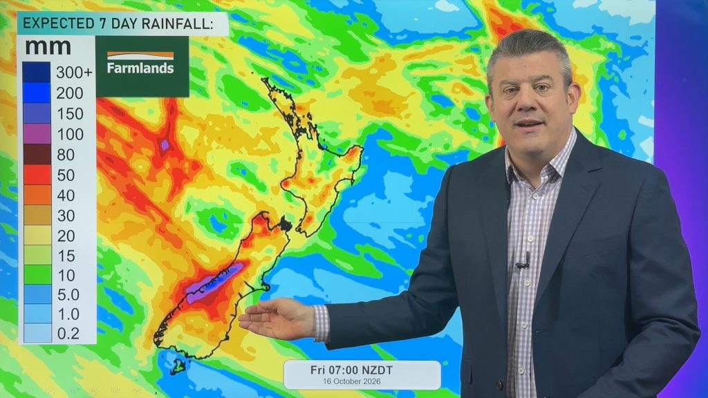
MetService is trending as New Zealand prepares for a significant cold change from the Southern Ocean. After a warm start to the week, temperatures are expected to tumble by Thursday, with some areas seeing drops of over 11 degrees [1, 2].

What happened
- Monday
Rain hits Waikato, Auckland, Northland, and the Coromandel Peninsula [1].
- Tuesday
Christchurch and Ashburton may reach 27C, which is roughly 10C above the average [1].
- Wednesday
Heavy rain is expected to move across the South Island [1].
- Thursday
A cold change arrives; Christchurch's high is forecast at 13C and Timaru at 12C [1].
What you need to know
Expect rain, gusty winds, and showers from Tuesday through Thursday [1].
Heavy rainfall is possible in Auckland, Waikato, Fiordland, and Westland [1].
Temperatures will drop sharply by late week, with some interior areas potentially seeing frost [2].
It is not confirmed if any specific weather warnings have been issued beyond general forecasts of heavy rain.
Background
The current weather pattern is driven by warm, moist air moving across the country, followed by cooler air from the Southern Ocean [1].
Meteorologists describe these changeable conditions as typical for the New Zealand spring season [1].
Questions people ask
Will the weather be extreme?
According to MetService, nothing extreme is expected [1].
Which areas will stay dry longer?
Gisborne and Hawke's Bay are expected to remain dry on Wednesday [1].
Where this came from
Found through Google Trends and drafted with AI from at least two cited sources. Published automatically after passing our automated checks for sources, wording and safety. It may not have been reviewed by a person yet. Report a correction.