


Why is the 2026 El Niño trending today?
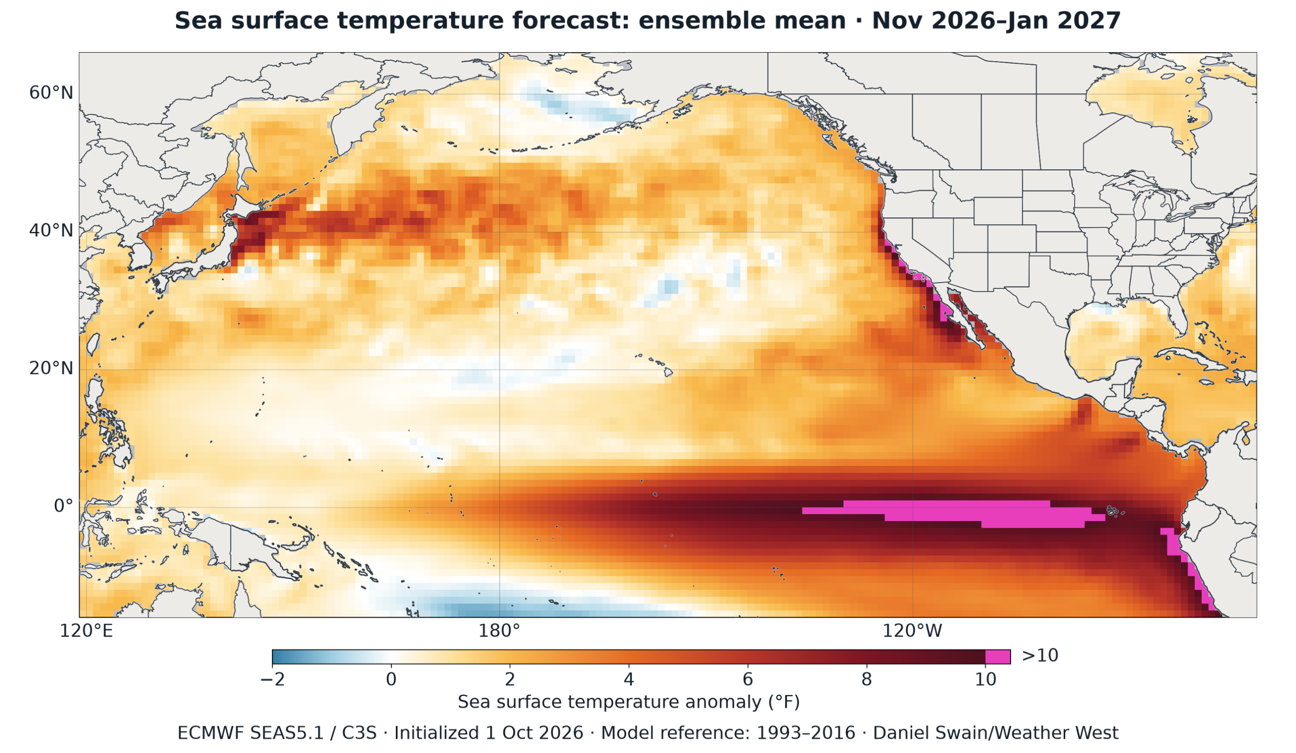
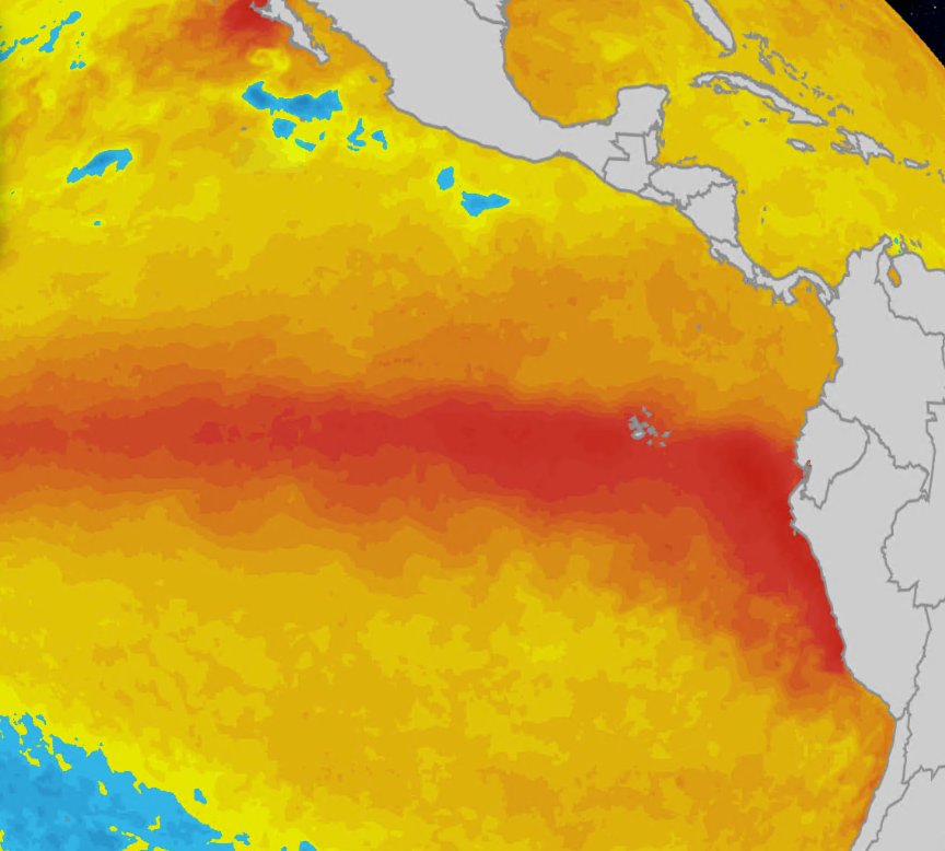
The 2026 El Niño is trending because it has already become the strongest on record by most metrics and is expected to intensify further. Meteorologists warn it could bring historic winter impacts to the Southwestern U.S. and California.
What happened
- Earlier this summer
An El Niño event officially began in the tropical Pacific Ocean [1].
- July
Tropical storms and hurricanes began indirectly affecting southern and central California [1].
- 7 Oct, 2026
Isaias became the first hurricane of the season, the latest such occurrence in the satellite era [2].
- Mid-October, 2026
The event is now the strongest on record by nearly every metric [1].
What you need to know
Strong El Niños typically lead to wetter winters for the southern United States [2].
The Atlantic hurricane season is often quieter during these events, while the central and eastern Pacific are more active [2].
Global impacts can include droughts in Indonesia and Australia [2].
Economic risks include disruptions to food production and power generation [3].
It is not yet confirmed how long the event will last or exactly how severe the regional weather impacts will be [3].
Background
El Niño is a recurring climate cycle involving the warming of water in the central and eastern Pacific Ocean near the equator [2]. It usually occurs every three to four years and can shift global weather patterns for several months [2].
The 2026 event was predicted as early as mid-spring by several physics-based models [1]. Since then, it has caused record-breaking coastal humidity and water temperatures in Southern California, leading to flooding and erosion [1].
Questions people ask
How does El Niño affect hurricanes?
It generally creates hostile conditions for Atlantic hurricanes through stronger wind shear, but increases activity in the central and eastern Pacific [2].
What is a 'westerly wind burst'?
These are key processes that trigger and strengthen El Niño; while they can cause temporary local cooling, they ultimately lead to net warming [1].
Where this came from
[1] weatherwest.com
El Niño, already near/at record intensity, will further strengthen to historic level and likely bring major California & SW U.S. winter impacts
Preview image from weatherwest.com
 [2] weather.com
What a historic super El Niño ahead means for your fall and winter
Preview image from weather.com
[2] weather.com
What a historic super El Niño ahead means for your fall and winter
Preview image from weather.com
 [3] troweprice.com
El Niño returns: From climate signal to sovereign risk
Preview image from troweprice.com
[3] troweprice.com
El Niño returns: From climate signal to sovereign risk
Preview image from troweprice.com
Found through Google Trends and drafted with AI from at least two cited sources. Published automatically after passing our automated checks for sources, wording and safety. It may not have been reviewed by a person yet. Report a correction.